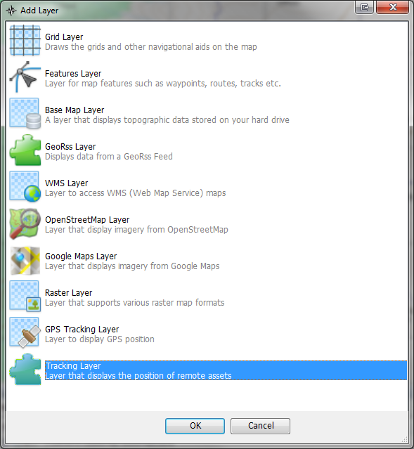
What’s this? A screenshot that isn’t a map? Yes, boring, but it demonstrates the various capabilities we are planning for TrueNorth — check out the layers we have here under development.

Hopefully the layers speak for themselves, but here’s a quick summary.
- Grid Layer: draws the graticule and what cartographer’s call map furniture: these are items that aren’t necessarily part of the the map, but make it useful. The grid is an aid for navigators, as is the scale, declination, and compass rose.
- Features Layer: this is the main layer to add items to the map. These could be waypoints and tracks imported from a file or uploaded from a GPS. It could also be circles and polygons that assist people in laying out areas and regions of interest on the map.
- Base Map Layer: a layer that draws topographic maps that you have on your hard drive.
- GeoRSS Layer: draws information derived from a GeoRSS feed.
- WMS Layer: draws map imagery downloaded from a WMS (Web Map Service) server.
- OpenStreetMap Layer: draw map tiles downloaded from OpenStreetMap.org.
- Google Maps Layer: draws map tiles downloaded from Google Maps.
- Raster Layer: draw map imagery from raster files such as MrSID, GeoTIFF and other geo-referenced raster data.
- GPS Tracking Layer: displays and records current position and other navigational data from a GPS directly connected to the computer.
- Tracking Layer: displays and records positional data from remote sources such as APRS and other asset tracking sources.
Several of these are under development and testing. In particular I’m very excited about the GPS and tracking layers.
Leave a Reply
You must be logged in to post a comment.